

详细内容

Unlock more satellite insight for less!

Satellite Data Analytics For Daily Earth Insights & Decision-making
We leverage the capabilities of satellite-based monitoring and data analytics to improve decision-making and drive sustainability across the globe.
EOS Data Analytics is at the forefront of harnessing the power of satellite technologies to drive businesses with fast and actionable data while preserving the environment. We are among the leading global satellite data providers specializing in generating sustainable satellite-driven AI-powered solutions in agriculture and forestry, with the ability to extend solutions to other niches upon request.
Explore options
Our case studies and success stories
[ \
\
- Case study\
\
UK Farming Cooperative Uses SatTech To Optimize Harvest](https://eos.com/blog/uk-farming-cooperative-uses-sattech-to-optimize-harvest/)
[ \
\
- Case study\
\
EOSDA With Crosscheck Analyzes Soybean Fields For EUDR](https://eos.com/blog/case-study-of-soybean-fields-analysis-with-crosscheck/)
[ \
\
- Case study\
\
Analyzing Seized Arable Land In Ukraine For PEJ](https://eos.com/blog/analyzing-seized-arable-land-in-ukraine-for-pej/)
[ \
\
- Case study\
\
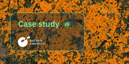
EOSDA Validates Sugarcane Mapping In São Paulo](https://eos.com/blog/eosda-validates-sugarcane-mapping-in-sao-paulo/)
[\
\
- Case study\
\
Mapping Iowa: Smarter Crop ID And Field Boundaries](https://eos.com/blog/mapping-iowa-smarter-crop-id-and-field-boundaries/)
[\
\
- Case study\
\
Boundaries And Crop Types: A Custom Project In Texas](https://eos.com/blog/boundaries-and-crop-types-a-custom-project-in-texas/)
[\
\
- Case study\
\
Changing Sugarcane Yield Estimation In São Paulo](https://eos.com/blog/changing-sugarcane-yield-estimation-in-sao-paulo/)
[\
\
- Case study\
\
How Scientists Use EOSDA LandViewer: A Practical Case](https://eos.com/blog/how-scientists-use-eosda-landviewer-a-practical-case/)
[\
\
- Case study\
\
Monitoring Urban Development With EOSDA’s Solutions](https://eos.com/blog/monitoring-urban-development-with-eosdas-solutions/)
[\
\
- Stories of impact\
\
Agriculture In Chiapas Takes Regenerative Path Forward](https://eos.com/blog/agriculture-in-chiapas-takes-regenerative-path-forward/)
‹›
Sustainable vision \
\
We produce environmentally friendly analytics solutions for making profits in a way that is compatible with our planet's needs. In-house experts \
\
To ensure our satellite image analysis products and solutions truly meet the needs of our clients, we have a team of experts in their respective fields, including PhDs with 30 years of experience. Advanced spatial data sources \
\
Comprehensive satellite analytics: we combine from a wide array of sources, including satellite imagery, historical parameters, custom indices, and more.
EOSDA In a Nutshell
EOS Data Analytics is a leading expert in satellite data analytics, with a deep focus on agriculture and forestry. Within our sustainability vision, we use GIS data to globally drive business profits while preserving the environment.

 \
 \
 \




‹›
Member of AgGateway

Member of International Astronautical Federation

AgTech Breakthrough Awards 2022: Yield Forecasting Solution of the Year

GEO SDG 2022 Award: Commercial category

Society for Agricultural Research & Management (SARM): 2023 Business Innovator Award
‹›
Georgian Farmers Association
The brightest moment of cooperation with EOSDA was the partnership management and communication. We are very happy that such a strong company is in our corner. We are looking forward to giving more farmers access to this system and promoting it and better training them to be more digitally friendly.

REDtone
Once we started partnering with EOSDA, we've found that we have more insights into the possibilities of satellite monitoring and the applications that we can provide to industries in Malaysia.

The Stream Ltd.
We've had unrelating support from EOSDA to enable us to find the best ways to deliver the platform alongside our existing business model.

Complete Farmer
We have found vegetation indices especially useful when it comes to precise fertilizer application and weed control. Another vital area of interest for us is soil moisture monitoring. EOSDA Crop Monitoring helps us improve production today so we can feed more people tomorrow.

AgroXchange
We’ve been working with EOS Data Analytics since 2020 and, over this time, we managed to open several new precision agriculture markets in West Africa via EOSDA White Label solution. We have established a truly symbiotic relationship with EOSDA and we’re moving on to greater heights. Looking forward to more achievements!

Agrinova Group
EOSDA Crop Monitoring innovates our services and prevents our customers from wasting their money and resources. [The platform's] innovations will have a positive impact on the yield per hectare, customer profit, and overall environment.

Georgian Farmers Association
The brightest moment of cooperation with EOSDA was the partnership management and communication. We are very happy that such a strong company is in our corner. We are looking forward to giving more farmers access to this system and promoting it and better training them to be more digitally friendly.
REDtone
Once we started partnering with EOSDA, we've found that we have more insights into the possibilities of satellite monitoring and the applications that we can provide to industries in Malaysia.
The Stream Ltd.
We've had unrelating support from EOSDA to enable us to find the best ways to deliver the platform alongside our existing business model.
Complete Farmer
We have found vegetation indices especially useful when it comes to precise fertilizer application and weed control. Another vital area of interest for us is soil moisture monitoring. EOSDA Crop Monitoring helps us improve production today so we can feed more people tomorrow.
AgroXchange
We’ve been working with EOS Data Analytics since 2020 and, over this time, we managed to open several new precision agriculture markets in West Africa via EOSDA White Label solution. We have established a truly symbiotic relationship with EOSDA and we’re moving on to greater heights. Looking forward to more achievements!
Agrinova Group
EOSDA Crop Monitoring innovates our services and prevents our customers from wasting their money and resources. [The platform's] innovations will have a positive impact on the yield per hectare, customer profit, and overall environment.
‹›

- EOSDA LandViewer
BlackSky Imagery Expands The EOSDA LandViewer Offering
EOSDA LandViewer has expanded its capabilities by reselling BlackSky imagery. With better detail, more revisits, and flexible tasking, it’s easier than ever to follow changes on the ground.
Maksym Sushchuk 27.10.2025

- Crop management
NDVI vs. NDRE: Comparing Uses And Pros For Farmers
NDVI and NDRE help track crop health at every growth stage, from early-season greenness to late-season dense canopies. Learn when and how to use each index for the best results.
Maksym Bohomolov 16.09.2025

- Agricultural practices
Grid Soil Sampling & Its Role In Precision Agriculture
Grid soil sampling is nothing new, but satellites make it easier and cheaper: improve pre-sampling planning, help collect probes efficiently, and combine the results with other soil and crop data.
Maksym Bohomolov 28.08.2025

- EOSDA LandViewer
EOSDA LandViewer Black Friday Sale: Exclusive Offers & Giveaway
This Black Friday, LandViewer offers new users the chance to save on monthly plans, get extra months with yearly subscriptions, and participate in a free annual plan giveaway.
Maksym Sushchuk 17.11.2025

- EOSDA LandViewer
EOSDA LandViewer Adds SpaceWill And Improsat Sources
EOSDA LandViewer expands with new SpaceWill and Improsat satellite data sources. This means higher resolution and more frequent revisits for accurate monitoring.
Maksym Sushchuk 29.10.2025

- EOSDA LandViewer
BlackSky Imagery Expands The EOSDA LandViewer Offering
EOSDA LandViewer has expanded its capabilities by reselling BlackSky imagery. With better detail, more revisits, and flexible tasking, it’s easier than ever to follow changes on the ground.
Maksym Sushchuk 27.10.2025

- Crop management
NDVI vs. NDRE: Comparing Uses And Pros For Farmers
NDVI and NDRE help track crop health at every growth stage, from early-season greenness to late-season dense canopies. Learn when and how to use each index for the best results.
Maksym Bohomolov 16.09.2025

- Agricultural practices
Grid Soil Sampling & Its Role In Precision Agriculture
Grid soil sampling is nothing new, but satellites make it easier and cheaper: improve pre-sampling planning, help collect probes efficiently, and combine the results with other soil and crop data.
Maksym Bohomolov 28.08.2025

- EOSDA LandViewer
EOSDA LandViewer Black Friday Sale: Exclusive Offers & Giveaway
This Black Friday, LandViewer offers new users the chance to save on monthly plans, get extra months with yearly subscriptions, and participate in a free annual plan giveaway.
Maksym Sushchuk 17.11.2025

- EOSDA LandViewer
EOSDA LandViewer Adds SpaceWill And Improsat Sources
EOSDA LandViewer expands with new SpaceWill and Improsat satellite data sources. This means higher resolution and more frequent revisits for accurate monitoring.
Maksym Sushchuk 29.10.2025

- EOSDA LandViewer
BlackSky Imagery Expands The EOSDA LandViewer Offering
EOSDA LandViewer has expanded its capabilities by reselling BlackSky imagery. With better detail, more revisits, and flexible tasking, it’s easier than ever to follow changes on the ground.
Maksym Sushchuk 27.10.2025
‹›