

详细内容
Automate What You See from the Sky
Use AI Agents to detect, monitor, and inspect at scale, fast and precise
Save up to 99.7% of your time with AI agent-based automation of satellite, aerial and drone image analysis
Join 10,000+ users working with FlyPix AI daily. See reviews




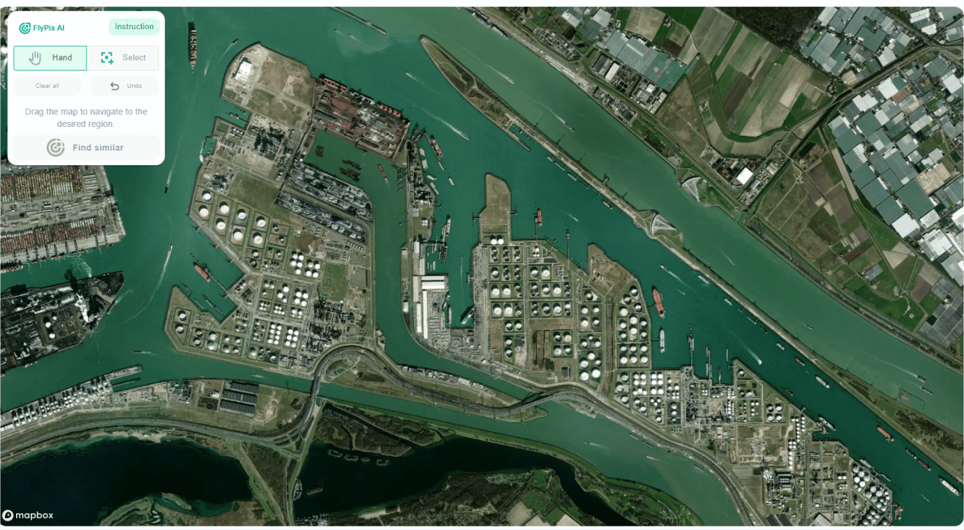
Experience the future of geospatial analysis with FlyPix! Start your free trial today
Save 99,7% of Your Time with FlyPix
Leveraging advanced AI, FlyPix quickly identifies and outlines numerous objects
in geospatial images, making it perfect for analyzing complex and dense scenes.
Manual Annotate
Time Spend: 997s
Manual Annotate
Time Spend: 430s
Manual Annotate
Time Spend: 3200s
VS
AI Annotate by FlyPix
Time Spend: 3s
Industries Benefiting from FlyPix AI- Driven Geospatial Solutions
Leveraging advanced AI, FlyPix quickly identifies and outlines numerous objects
in geospatial images, making it perfect for analyzing complex and dense scenes.
Construction
Port Operations
Agriculture
Infrastructure Maintenance
Forestry
Government
Ecotechnology

Your Industry
FlyPix adapts to your unique needs. Train AI models and get Individual geospatial analysis for any type of industry.
Discover how FlyPix can
transform your projects.
Our Testimonials
See what our clients are saying
We at acitoflux ran a joint pilot with FlyPix AI on in an industrial setting. We were impressed of the dedicated and easy-to-work-with team, expertise, and quick application of the technology to a novel use-case.

Hannes Olbrich Head of Investor Office
acitoflux, Germany
FlyPix AI helped us go from idea to proof of concept in record time. Their team was responsive, the platform easy to integrate, and we were able to test geospatial insights on real property data within days.

Ali Tehranchi CEO
Bayscenary, USA
What surprised us most was how effortless it was to start using FlyPix AI. The platform is robust, easy to navigate, and extremely reliable.

Krishna Mohan Business Head
Stesalit Systems Ltd., India
FlyPix AI made it remarkably easy to turn drone imagery into actionable results, truly the next-gen tech. providing the power of AI-driven analysis and cloud computing within minutes without the need for complex setups.

Jordan BatesResearcher
University of Liège, Belgium
Working with FlyPix.ai has significantly elevated the impact of our clean-up missions. We're proud to collaborate with a team that shares our values and commitment to environmental responsibility.

Robin EngelhardChairman, Second Life e.V. Germany
FlyPix AI helped us automate land-use classification with incredible precision and speed, saving months of manual work.

Rohit SinghDirector
Intent to Solution, India
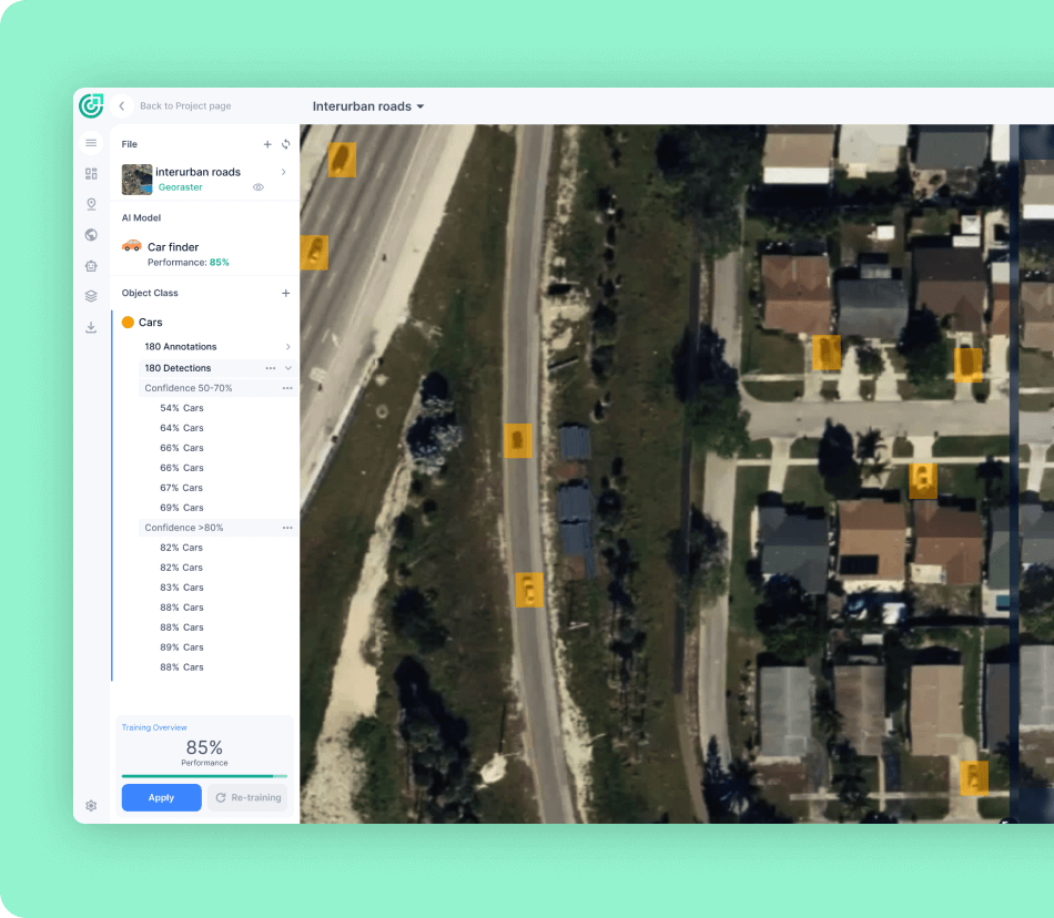
Create the AI model
Train custom AI models, without programming knowledge or deep knowledge of AI, with user-defined annotations to detect any objects visible in an image or raster, according to your specific needs.
Choose Your Adventure!
Pricing
Pricing in € EUR
Basic
Free/ 1 user seat
Storage
3GB
One Time
10 Credits
recharge anytime
-
Analytics & AI
- Access to Flypix AI models
- AI Model training
- AI model prediction/detection
- Access to Analytics dashboard
-
Support
- Limited
-
Advanced Features
- Multispectral Data
Starter
€50/ 1 user seat/mo
Save 10% when billed annually
Storage
10GB
Monthly Credits
50 Credits
Processing 1 Gigapixels
-
Analytics & AI
- Access to Flypix AI models
- AI Model training
- AI model prediction/detection
- Access to Analytics dashboard
-
Support
- within 5 business day emails only
-
Collaboration
- Export vector layer
-
Advanced Features
- Multispectral Data
Standard
€500/ 2 user seat/mo
Save 10% when billed annually
Storage
120GB
Monthly Credits
500 + 100 Credits
Processing 12 Gigapixels
-
Analytics & AI
- Access to Flypix AI models
- AI Model training
- AI model prediction/detection
- Access to Analytics dashboard
-
Support
- Emails 2 business day
-
Collaboration
- Export vector layer
- Sharing the map
-
Advanced Features
- Multispectral Data
Professional
€2000/ 5 user seat/mo
Save 10% when billed annually
Storage
600GB
Monthly Credits
2,000 + 1,000 Credits
Processing 60 Gigapixels
-
Analytics & AI
- Access to Flypix AI models
- AI Model training
- AI model prediction/detection
- Access to Analytics dashboard
-
Support
- Emails 1 hour
- Support chat
-
Collaboration
- Publish the map
- Export vector layer
- Sharing the map
- Access control and team management
-
Advanced Features
- Access to API
- Extra Quality Assurance with GIS experts
- White label
- Multispectral Data
Our latest news

FlyPix AI Joins AWS GenAI Launchpad Kickoff in Berlin: From POC to Production
Ivan Tankoyeu
May 19, 2025
We’re excited to share that FlyPix AI took part in the inaugural AWS GenAI Launchpad in Berlin —

FlyPix AI Showcases Innovation at Block im Park 2025
Ivan Tankoyeu
May 18, 2025
Frankfurt, Germany – May 18, 2025 Dr. Sergey Sukhanov, CEO of FlyPix AI, represented the company at this

FlyPix AI Joins InsureLab Germany’s Batch #25 to Drive GeoAI Innovation in Insurance
Ivan Tankoyeu
May 14, 2025
We’re excited to share that FlyPix AI has been selected for InsureLab Germany’s Batch #25—a leading collaboration program

FlyPix AI Showcases Foundation Model Breakthroughs at ESA/NASA Workshop
Ivan Tankoyeu
May 6, 2025
This week, FlyPix AI joined leading minds in Earth Observation and Artificial Intelligence at the ESA/NASA International Workshop
Experience the future of geospatial analysis with FlyPix!
Leveraging advanced AI, FlyPix quickly identifies and outlines numerous objects in geospatial images,
making it perfect for analyzing complex and dense scenes.